PA State Archives Hours, Directions, & Fees Research Topics Online Catalog Land Records


Pennsylvania Historical and Museum Commission
Pennsylvania State Archives


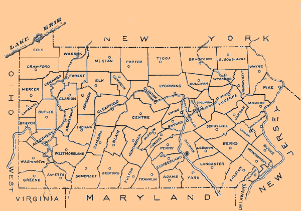
Pennsylvania County Municipalities Map

To view a particular county map which illustrates its municipalities, hover the cursor over and then left-click the mouse on that county. To magnify the individual county maps, move the cursor over the map and left-click on the magnifying glass when it appears. The images were produced in 1960 by the Department of Commerce.

Please note that these files are in a PDF format and will require the use of Adobe's Acrobat Reader. Get Adobe Acrobat Reader by clicking here. If you are using a screen reader, Adobe also offers a free online document conversion service at http://access.adobe.com.


Erie County Warren County Crawford County McKean County Mercer County Venango County Forest County Elk County Cameron County Clinton County Potter County Lycoming County Tioga County Bradford County Susquehanna County Sullivan County Wyoming County Lackawanna County Wayne County Lawrence County Bulter County Beaver County Washington County Greene County Allegheny County Clarion County Armstrong County Westmoreland County Fayette County Indiana County Jefferson County Clearfild County Centre County Cambria County Blair County Summerset County Bedford County Fulton County Huntingdon County Miflin County Union County Snyder County Juniata County Perry County Franklin County Cumberland County Adams County York County Northumberland County Coumbia County Luzerne County Pike County Monroe County Carbon County Northampton County Schuylkill County Dauphin County Lebanon County Berks County Lehigh County Chester County Lancaster County Delaware County Montgomery County Philadelphia County Bucks County Montour County

PA State Archives Hours, Directions, & Fees Research Topics Online Catalog Land Records