Pennsylvania Canal Maps
Map Book #11
|
Please
select a map tile to view larger version (individual tiles are PDF
files, approximately 1-2 MB in size)
|
|
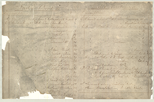
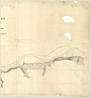
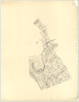
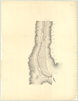
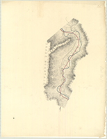
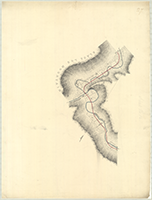
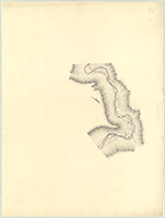
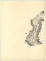
Book 11, page 00 Index. (1 section) |
|
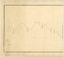
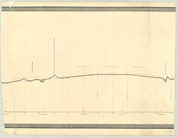
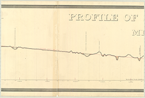
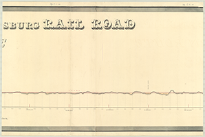
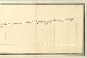
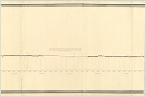
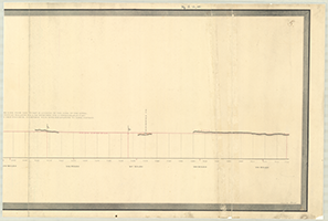
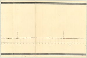
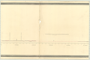
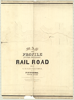
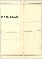
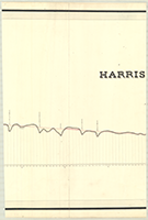
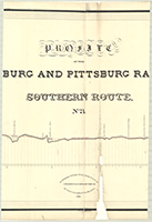
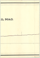
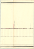
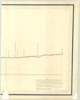
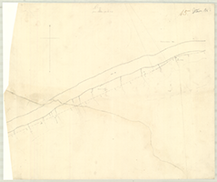
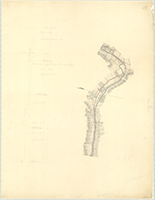
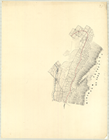
Book 11, page 01 "Level of Proposed Tunnel at Sugar Run Gap, 160 Ft. below Portage Summit," n.d. [Harrisburg & Pittsburgh Rail Road]. Profile of the Great Line of the Allegheny Miountains from Cedar Swamp Gap to the Three Springs Gap, a distance of 44 miles, collected from different surveys. (3 sections) |
  |
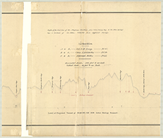
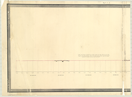
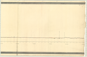
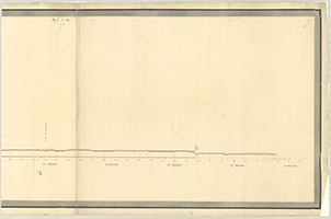
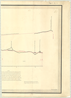
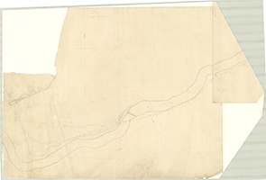
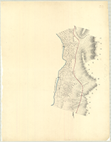
Book 11, page 02 [Middle Route. Harrisburg & Pittsburg Rail Road. Summit along Leading Ridge], n.d. Drawn by J. Welch. From 23 miles to 30 miles the Eastern end of the Gap formed by the Little Juniata River through Tussey's Mountain. (2 sections) |
   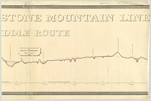 |
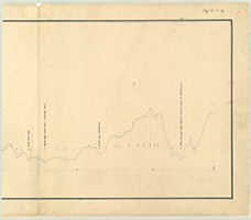
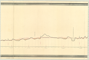
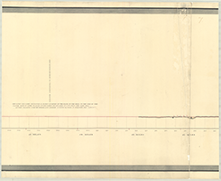
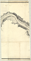
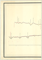
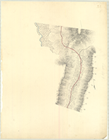
Book 11, page 03 "Profile of Stone Mountain Line. Middle Route (Harrisburg to Pittsburgh Rail Road)." Surveyed under the Direction of Charles L. Schlatter, C. E. By John A. Roebling, Principal Assistant, 1841. From 1 mile, West Breanch of Kishicoquillas Creek to Manor Hill Town. (5 sections, section 3 missing) |
     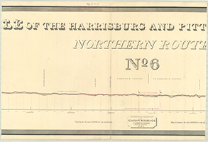    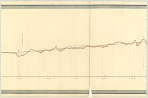  |
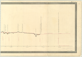
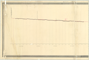
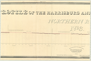
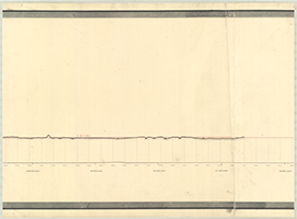
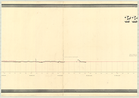
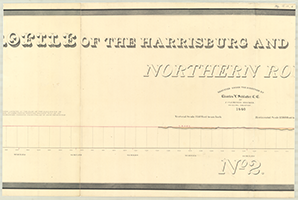
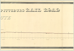
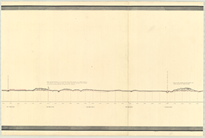
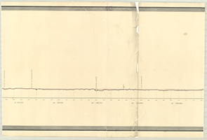
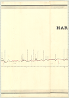
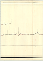
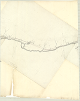
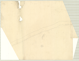
Book 11, page 04 "Profile of the Harrisburg and Pittsburg Rail Road. Northern Route, No. 6." Surveyed under the Direction of Charles L. Schlatter, C. E. J. Clements Stocker, Principal Assistant, 1840. Drawn by J. Welch. From 1 mile to beyond Burn's Run. (11 sections) |
 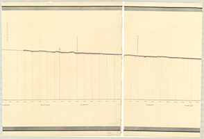  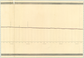         |
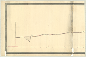
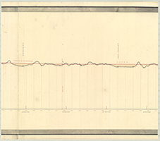
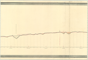
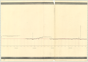
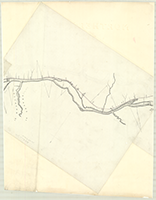
Book 11, page 05 "Profile of the Harrisburg and Pittsburg Rail Road. Northern Route, No. 3." Surveyed under the Direction of Charles L. Schlatter, C. E. J. Clements Stocker, Principal Assistant, 1840. Drawn by J. Welch. From Nippeneoes Creek, 105 miles to Hannah Furnace, 164 miles. (12 sections) |
         |
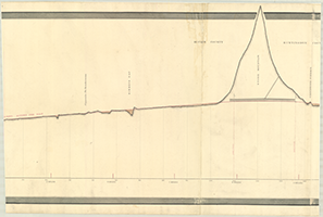
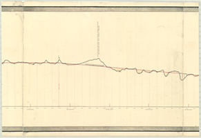
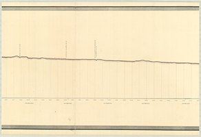
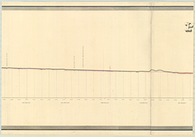
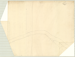
Book 11, page 06 "Profile of the Harrisburg and Pittsburg Rail Road. Northern Route, No. 2." Surveyed under the Direction of Charles L Schlatter, C. E. By J. Clements Stocker, Principle Assistant, 1840. From Lewisburg, 61 miles to 104 miles-beyond Hagerman's Run opposite Williamsport. (9 sections) |
   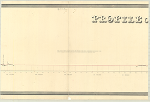 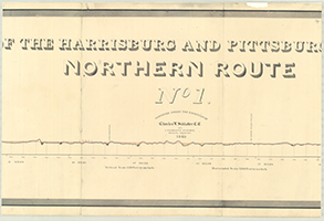 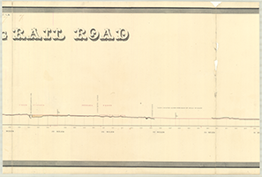 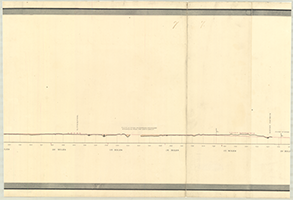   |
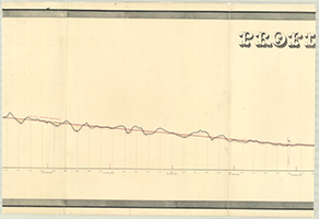
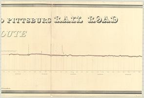
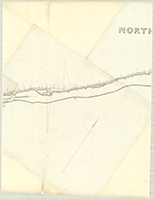
Book 11, page 07 "Profile of the Harrisburg and Pittsbur Rail Road. Northern Route, No. 1." Surveyed under the Direction of Charles L. Schlatter, C. E. By J. Clements Stocker, Principal Assistant, 1840. From New Buffalo, 16 miles to Turkey Creek, 59 miles. (9 sections) |
    |
Book 11, page 08 "Map and Profile of the Proposed Rail Road from Laughlinstown to Pittsburg," n.d. Charles DeHass, P. Engineer. (4 sections) |
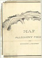 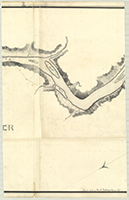  |
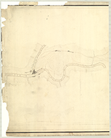
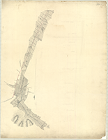
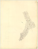
Book 11, page 09 "Map. Allegheny Feeder from Kittaning to Freeport," drawn by John A. Roebling, 1839. (3 sections) |
  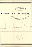   |
Book 11, page 10 "Profile of the Harrisburg and Pttsburg Rail Road. Southern Route, No. 2." Surveyed under the Direction of Charles L. Schlatter, C. E. By John A. Roebling, Pr: Asst., 1839. Drawn by W. Gill. From mouth of Brush Creek to Greensburg. (5 sections) |
       |
Book 11, page 11 "Profile of the Harrisburg and Pittsburg Rail Road. Southern Route, No. 3." Surveyed under the Direction of Charles L. Schlatter, C. E. By John A. Roebling, Pr: Asst., 1839. Drawn by W. Gill. From Greensburg to Laughlinstown. (7 sections) |
   |
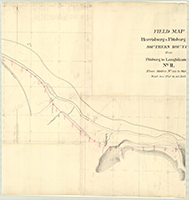
Book 11, page 12 "Field Map. Harrisburg & Pittsburg R.R. Southern Route from Pittsburg to Laughlinstown No. III," n.d. From Station No. 179 to Station No. 232 7/8. (3 sections) |
    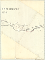   |
Book 11, page 13 "Northern Route, No. 8," n.d. [Harrisburg & Pittsburg Rail Road]. From Mill Hall to Curtam's [Curtin's] Forge including Beach Run, Bullet Run, Howardville, Penn. Canal, Saw Mill, Howard Furnace, Rolling Mill. (7 sections) |
   |
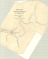
Book 11, page 14 "Field Map. Harrisburg & Pittsburg R.R. Southern Route from Pittsburg to Laughlinstown No. 11," n.d. From Station No. 122 to Station No. 179. Shows: Chalfant's Tavern, Turnpike Road from Pittsburg to Chambersburg. (3 sections) |
        |
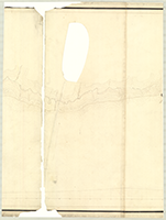
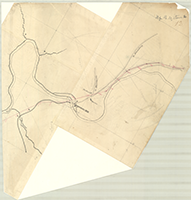
Book 11, page 15 [Middel Route. Proposed Route along the Juniata, Perrysville], n.d. Station No. 955 to Station No. 1538. Sections No. 17 to No. 25, No. 21 missing. Shows: Perry's Ville, Mifflin, Canal. (8 sections) |
 |
Book 11, page 16 [Map and Profile for a railroad from Chambersburg to Pittsburg; From Chambersburg, 1 mile to beyond Myer's, 4 miles], n.d. (1 section) |
 |
Book 11, page 17 [Map and Profile for a railroad from Chambersburg to Pittsburg; From 4 miles to Conecogheague Creek, 8 miles], n.d. (1 section) |
 |
Book 11, page 18 [Map and Profile for a railroad from Chambersburg to Pittsburg; On Conecogheague Creek, 8 to 12 miles], n.d. (1 section) |
 |
Book 11, page 19 [Map and Profile for a railroad from Chambersburg to Pittsburg; From Conecogheague Creek, 12 miles to beyond Black Creek, 16 miles], n.d. (1 section) |
 |
Book 11, page 20 [Map and Profile for a railroad from Chambersburg to Pittsburg; From 16 miles, over West Conecogheague Creek to 20 miles] n.d. (1 section) |
 |
Book 11, page 21 [Map and Profile for a railroad from Chambersburg to Pittsburg; From 20 miles, over Cove or Tuscarora Mountain to 24 miles], n.d. (1 section) |
 |
Book 11, page 22 [Map and Profile for a railroad from Chambersburg to Pittsburg; Tuscarora Mountain at Millers Tavern, 24 miles to 28 miles], n.d. (1 section) |
 |
Book 11, page 23 [Map and Profile for a railroad from Chambersburg to Pittsburg; From 28 miles over Little Aughwick Creek to 32 miles], n.d. (1 section) |
 |
Book 11, page 24 [Map and Profile for a railroad from Chambersburg to Pittsburg; From 32 miles to Burnt Cabins, 36 miles], n.d. (1 section) |
 |
Book 11, page 25 [Map and Profile for a railroad from Chambersburg to Pittsburg; From Burnt Cabins, 36 miles to Shade Mt., 40 miles], n.d. (1 section) |
 |
Book 11, page 26 [Map and Profile for a railroad from Chambersburg to Pittsburg; From Shade Mt., 40 miles to beyond Snyders', 44 miles], n.d. (1 section) |
 |
Book 11, page 27 [Map and Profile for a railroad from Chambersburg to Pittsburg; From 44 miles over Black Log Mountain to 48 miles], n.d. (1 section) |
 |
Book 11, page 28 [Map and Profile for a railroad from Chambersburg to Pittsburg; From 48 miles over Sideling Hill Creek to 52 miles], n.d. (1 section) |
 |
Book 11, page 29 [Map and Profile for a railroad from Chambersburg to Pittsburg; From 52 miles over Sideling Hill Creek to 56 miles], n.d. (1 section) |
 |
Book 11, page 30 [Map and Profile for a railroad from Chambersburg to Pittsburg; From Sideling Hill Gap, 56 miles to beyond Readys, 60 miles], n.d. (1 section) |
 |
Book 11, page 31 [Map and Profile for a railroad from Chambersburg to Pittsburg; From 60 miles over Broad Top Mountain to 64 miles], n.d. (1 section) |
 |
Book 11, page 32 [Map and Profile for a railroad from Chambersburg to Pittsburg; From Well's Valley, 64 miles to Ground Hog Valley, 68 miles], n.d. (1 section) |
 |
Book 11, page 33 [Map and Profile for a railroad from Chambersburg to Pittsburg; From 68 miles to Harbour Mountain, 72 miles], n.d. (1 section) |
 |
Book 11, page 34 [Map and Profile for a railroad from Chambersburg to Pittsburg; From Bill's Run, 72 miles over Allegripus Mt. to 76 miles], n.d. (1 section) |
 |
Book 11, page 35 [Map and Profile for a railroad from Chambersburg to Pittsburg; Over Woodcock Valley from 76 miles to 80 miles], n.d. (1 section) |
 |
Book 11, page 36 [Map and Profile for a railroad from Chambersburg to Pittsburg; From 80 miles along Raystown Branch to 84 miles], n.d. (1 section) |
 |
Book 11, page 37 [Map and Profile for a railroad from Chambersburg to Pittsburg; From 84 miles along Raystown Branch to Dunning's Mt. 88 miles], n.d. (1 section) |