Pennsylvania Canal Maps
Map Book #12
|
Please
select a map tile to view larger version (individual tiles are PDF
files, approximately 1-2 MB in size)
|
|
Book 12, page 00 Index. (1 section) |
|
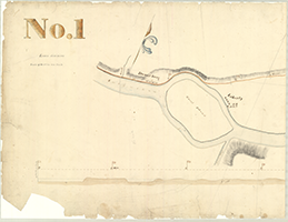
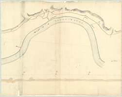
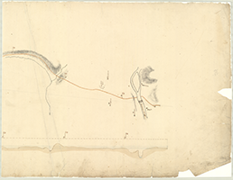
Book 12, page 01 [From Great Island, 1 mile to Hay's, 9 miles], n.d. "Maps and Profiles of the West Branch of the Susquehanna and tributaries and of the Susquehanna to the junction of the Juniata, surveyed by James Geddes, 1826-1827." Lower Division. (3 sections) |
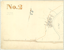   |
Book 12, page 02 [From Jersey Shore, 10 miles to Quinashahaque Run, 20 miles], n.d. Shows: Locks Nos. 61-63, Grist Mill. "Maps and Profiles of the West Branch of the Susquehanna and tributaries and of the Susquehanna to the junction of the Juniata, surveyed by James Geddes, 1826-1827." Lower Division. (3 sections) |
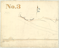   |
Book 12, page 03 [From Quinashahaque Run, 20 miles to beyond Williamsport, 30 miles], n.d. Shows: Lock No. 64. "Maps and Profiles of the West Branch of the Susquehanna and tributaries and of the Susquehanna to the junction of the Juniata, surveyed by James Geddes, 1826-1827." Lower Division. (3 sections) |
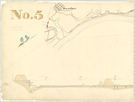 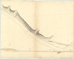 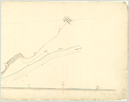 |
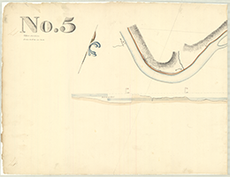
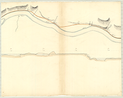
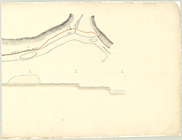
Book 12, page 05 (page 04 missing) [From Wolf's Run, 40 miles to Delaware Run, 50 miles], n.d. Shows: Locks Nos. 67-69, Pennsboro, Ferry. "Maps and Profiles of the West Branch of the Susquehanna and tributaries and of the Susquehanna to the junction of the Juniata, surveyed by James Geddes, 1826-1827." Lower Division. (3 sections) |
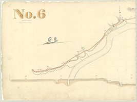   |
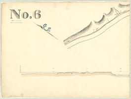
Book 12, page 06 [From Delaware Run, 50 miles to beyond Lock 73, 60 miles], n.d. Shows: Locks Nos. 70-73, Milton. "Maps and Profiles of the West Branch of the Susquehanna and tributaries and of the Susquehanna to the junction of the Juniata, surveyed by James Geddes, 1826-1827." Lower Division. (3 sections) |
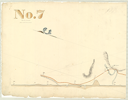   |
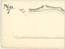
Book 12, page 07 [From 61 miles to Sunbury, 71 miles], n.d. Shows: Locks Nos. 74-89, Northumberland. "Maps and Profiles of the West Branch of the Susquehanna and tributaries and of the Susquehanna to the junction of the Juniata, surveyed by James Geddes, 1826-1827." Lower Division. (3 sections) |
   |
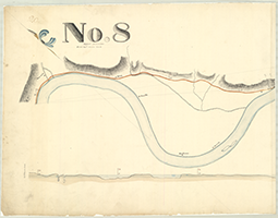
Book 12, page 08 [From Hummel's, 72 miles to Thornton's, 81 miles], n.d. Shows: Locks Nos. 76-77, Seelinsgrove. "Maps and Profiles of the West Branch of the Susquehanna and tributaries and of the Susquehanna to the junction of the Juniata, surveyed by James Geddes, 1826-1827." Lower Division. (3 sections) |
   |
Book 12, page 09 [From Lock No. 78, 81 miles to Lock No. 81, 91 miles], n.d. Shows: Locks 78-81, Feeder, Saw Mill. "Maps and Profiles of the West Branch of the Susquehanna and tributaries and of the Susquehanna to the junction of the Juniata, surveyed by James Geddes, 1826-1827." Lower Division. (3 sections) |
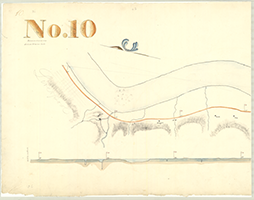   |
Book 12, page 10 [From 92 miles to Lock No. 84, 101 miles], n.d. Shows: Locks Nos. 82-84, Berry's Falls. "Maps and Profiles of the West Branch of the Susquehanna and tributaries and of the Susquehanna to the junction of the Juniata, surveyed by James Geddes, 1826-1827." Lower Division. (3 sections) |
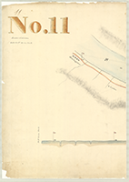 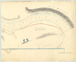 |
Book 12, page 11 [From New Buffalow, 102 miles to Duncan's Island, 106 miles], n.d. "Maps and Profiles of the West Branch of the Susquehanna and tributaries and of the Susquehanna to the junction of the Juniata, surveyed by James Geddes, 1826-1827." Lower Division. (2 sections) |
|
|
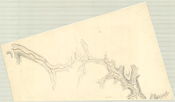
Book 12, page 12 "Map of the Susquehanna Valley, from Bald Eagle to Juniata," n.d. (8 sections) |
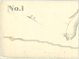 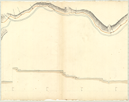  |
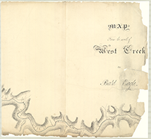
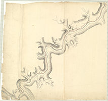
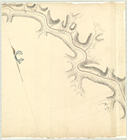
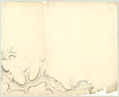
Book 12, page 13 [From West Creek, 1 mile to Lock No. 18, 10 miles], n.d. Shows: Locks Nos. 1-18. "West Creek, on the Driftwood Branch of the Sinnamahoning River to Bald Eagle Creek," n.d. Upper Division. (3 sections) |
   |
Book 12, page 14 [From Gundy's, 11 miles to Lock No. 30, 20 miles], n.d. Shows: Locks Nos. 19-30, Still House. "West Creek, on the Driftwood Branch of the Sinnamahoning River to Bald Eagle Creek," n.d. Upper Division. (3 sections) |
   |
Book 12, page 15 [From before Lock No. 31, 21 miles to Lock No. 38, 31 miles], n.d. Shows: Locks Nos. 31-38. "West Creek, on the Driftwood Branch of the Sinnamahoning River to Bald Eagle Creek," n.d. Upper Division. (3 sections) |
   |
Book 12, page 16 [From Lock No. 38, 31 miles to Lock No. 45, 42 miles], n.d. Shows: Locks Nos. 38-45. "West Creek, on the Driftwood Branch of the Sinnamahoning River to Bald Eagle Creek," n.d. Upper Division. (3 sections) |
   |
Book 12, page 17 [From Lock No. 46, 43 miles to Lock 50, 51 miles], n.d. Shows: Locks Nos. 46-50. "West Creek, on the Driftwood Branch of the Sinnamahoning River to Bald Eagle Creek," n.d. Upper Division. (3 sections) |
   |
Book 12, page 18 [From Green's, 52 miles to beyond Gurgen's, 61 miles], n.d. Shows: Locks Nos. 51-54. "West Creek, on the Driftwood Branch of the Sinnamahoning River to Bald Eagle Creek," n.d. Upper Division. (3 sections) |
   |
Book 12, page 19 [From Lock No. 55, 62 miles to Lock No. 58, 69 miles], n.d. Shows: Locks Nos. 55-58. "West Creek, on the Driftwood Branch of the Sinnamahoning River to Bald Eagle Creek," n.d. Upper Division. (3 sections) |
  |
Book 12, page 20 [From Que, 10 miles to N. Hannah, 74 miles], n.d. Shows: Locks Nos. 59-60. "West Creek, on the Driftwood Branch of the Sinnamahoning River to Bald Eagle Creek," n.d. Upper Division. (2 sections) |
     |
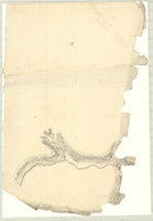
Book 12, page 21 "Map From the Mouth of West Creek to Bald Eagle," n.d. (5 sections) |
  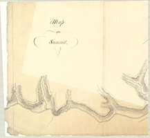  |
Book 12, page 22 "Map of the Summit and Elk Creek," n.d. (4 sections) |