Pennsylvania Canal Maps
Map Book #16
|
Please
select a map tile to view larger version (individual tiles are PDF
files, approximately 1-2 MB in size)
|
|
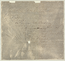
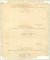
Book 16, page 00 Index. (1 section) |
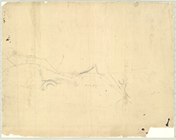 |
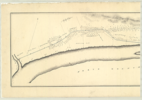
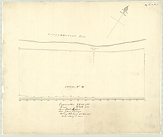
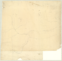
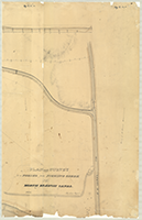
Book 16, page a [Map of North Branch Division and Canal from Nanticoke Falls to Wilkes Barre], n.d. (1 section) |
 |
Book 16, page b [North Branch Division and Canal], n.d. Fragile: Tracing Paper |
 |
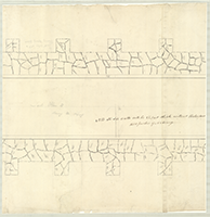
Book 16, page c "Plan to repair the breach made in the Nanticoke dam." Plan of dam Exhibitied 4 days previous to Thursday Feb. 27, 1834. (1 section) |
 |
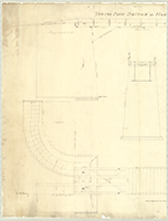
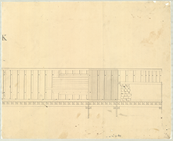
Book 16, page d [Towing Path Bridge?], n.d. (1 section) |
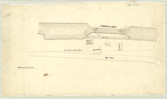    |
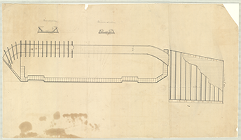
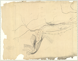
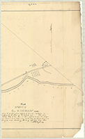
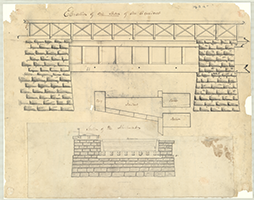
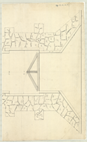
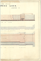
Book 16, page e [Berwick Lock], n.d. Shows: Waste Race, Proposed location of lock House, Old State house, Lock House, Wagon Road. (4 sections) |
 |
Book 16, page f "Plan of Gates for Lock No. 2, T. Extension," n.d. (1 section) |
  |
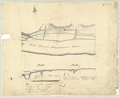
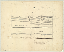
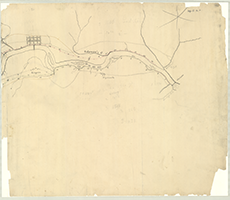
Book 16, page g [Survey No. 1 of North Branch Susquehanna River and Canal, from Fishing Creek to beyond Espytown], n.d. (2 sections) |
 |
Book 16, page h [Survey and Profile of North Branch Susquehanna River and Canal showing Locks Nos. 51 and 52], n.d. (1 section) |
 |
Book 16, page i [Survey and Profile of N.B. Susquehanna River and Canal showing Lock nos. 64 and 65], n.d. (1 section) |
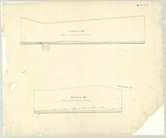 |
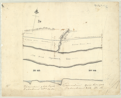
Book 16, page j [Sections Nos. 34 and 35 above Lackawanna Creek], n.d. (1 section) |
 |
Book 16, page k-1 [Profile of Sections No. 1 & No. 2 on Nanticoke Dam], n.d. (1 section) |
 |
Book 16, page k-2 [Profile, 85 to 103], n.d. |
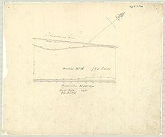 |
Book 16, page k-3 [Survey and Profile of Section No. 16], n.d. Drawing No. 8. (1 section) |
 |
Book 16, page k-4 [Top of Towing Paths on Sections Nos. 3, 4, 5 on East Side], n.d. (1 section) |
 |
Book 16, page k-5 [Survey and Profile of Section No. 15], n.d. Shows: Toll House on Market Street. Drawing No. 8. (1 section) |
 |
Book 16, page k-6 [Survey and Profile on N.B. Susquehanna River for Sections Nos. 53 and 54], n.d. (1 section) |
 |
Book 16, page k-7 [Profile from 7.8 to 10.8], n.d. (1 section) |
 |
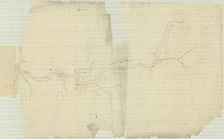
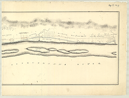
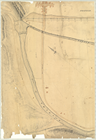
Book 16, page l [Survey of N.B. Susquehanna River and North Branch Canal from Abraham's Plains to above Lackawanna Creek], n.d. (1 section) |
  |
Book 16, page m "Towing Path Bridge at Harvey's Creek," N.F.J. May 22, 1841. (2 section) |
  |
Book 16, page n "Plan and Survey for a Feeder from Fishing Creek to the North Branch Canal," 1834. Robt. Faries, Engineer. (2 sections) |
  |
Book 16, page o "Map showing the Location of Canal and of Sections on Wyoming Line" [1831]. (2 sections) |
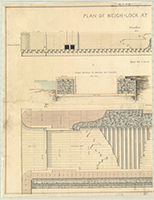 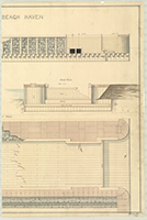 |
Book 16, page p-1 "Plan of Weigh-Lock at Beach Haven," Franks, 1847. Shows: Elevation, Ground Plan, Cross Section in Recess for Cradle, End View. (2 sections) |
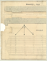  |
Book 16, page p-2 "Foundation of Lock," Franks. (2 sections) |
  |
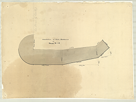
Book 16, page q "Plot of a part of Col. E. Inman's Farm," n.d. Showing quantity of land supposed to have been destroyed in consequence of the erection of the Nanticoke Dam... Surveyed underdirection of Board of Appraisors, May 1840. A.B. Warford. (2 sections) |
   |
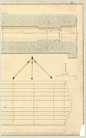
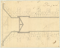
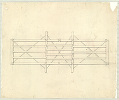
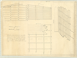
Book 16, page r "Lock Plan No. 1. Showing the position of the Lower Sills-The sheet piling and Longitudinal pieces...," n.d. (3 sections) |
  |
Book 16, page s "Lock, Elevation of the Frame," n.d. (2 sections) |
 |
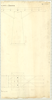
Book 16, page t "Elevation of one span of An Aqueduct," n.d. (1 section) |
  |
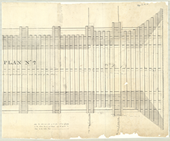
Book 16, page u-1 "Plan of Lock of 8 feet lift," n.d. (2 sections) |
   |
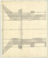
Book 16, page u-2 [Plan of Lock?], n.d. (3 sections) |
   |
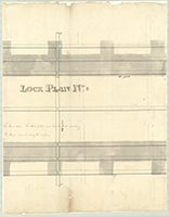
Book 16, page u-3 "Lock Plan 4," n.d. (3 sections) |
  |
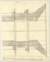
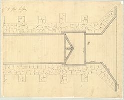
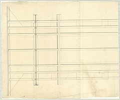
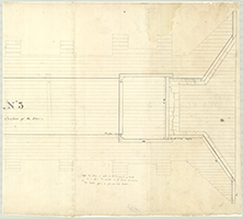
Book 16, page v "Lock Plan No. 2. Showing the position of the Longitudinal pieces and the Sills on the Floor," n.d. (2 sections) |
  |
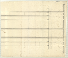
Book 16, page w "Lock Plan No. 3. Showing the Sills of the Frame and Surface of the Floor," n.d. (2 sections) |
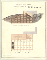 |
Book 16, page x "Proposed Plan For the mill Creek Dam, Luzerne Co.," n.d. Shows: Base, upper & lower slopes. (1 section) |
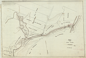 |
Book 16, page y "Map of the Mill Creek Navigation, 1855." Presented Decr. 1855 with Report of E.F. Gay, C. E. H.S. Butler, Civ. Eng. Tracing. (1 section) |
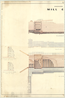  |
Book 16, page z "Proposed Plan For the Mill Creek Lock, Luzerne Co.," n.d. Shows: Elevation of Lock, Footing Course of Masonry, Plan of lock, section through upper and lower ends of locks. (2 sections) |
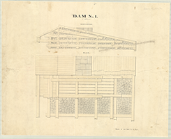 |
Book 16, page A "Dam No. 1, at Athens," n.d. Shows: Elevation, Plan. (1 section) |
 |
Book 16, page B "Plan of Repairs at Nanticoke Dam," n.d. Drawn by T.H. Walker. (1 section) |
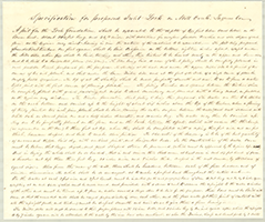  |
Book 16, page C-1 "Specification for Proposed Inclet Lock on Milll Creek, Luzerne Co." Submitted, December 1855, with Plan, by Edwd. F. Gay, C. Engineer. (2 sections) |
 |
Book 16, page C-2 "Specification of Dam on Mill Creek, Luzerne County, Pa." Submitted December 1855, with Plan. Edwd. F. Gay, C. Engineer. (1 section) |
 |
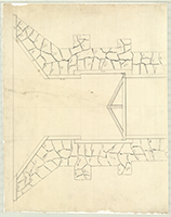
Book 16, page D "Foundation of East Abutment of Dam No. 14," n.d. (1 section) |
 |
Book 16, page E [Locks on?] "N. Branch," n.d. (1 section) |