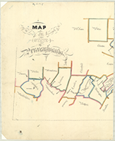
Pennsylvania Canal Maps
Map Book #18
|
Please
select a map tile to view larger version (individual tiles are PDF
files, approximately 1-2 MB in size)
|
|
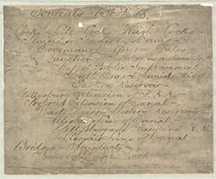
Book 18, page 00 Index. (1 section) |
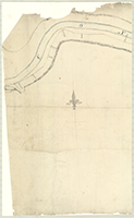 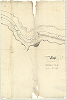 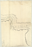 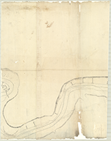 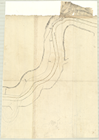 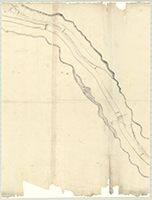 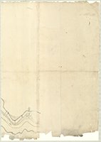 |
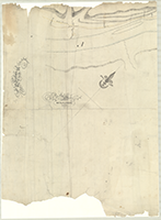
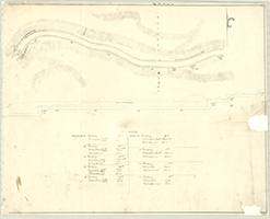
Book 18, page a "Map of the Ligonier Line of Canal, Western Division, n.d." (7 sections) |
 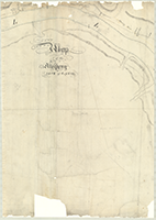       |
Book 18, page b "Map of the Allegheny Line of Canal, Western Division," n.d. (8 sections) |
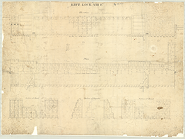 |
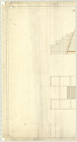
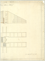
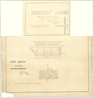
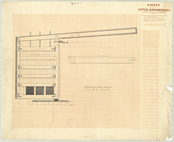
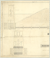
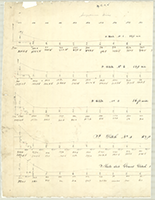
Book 18, page c "Lift Lock VIII Ft.," n.d. Shows: Elevation, Plan, Section at head, Section at Chamber, Section at Breast. (1 section) |
  |
Book 18, page d "No. 2. Plan of Sluice or Feeder," n.d. (2 sections) |
 |
Book 18, page e "No. 2. Plan of Dam or Overfall," n.d. (1 section) |
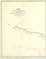 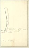 |
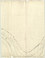
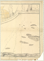
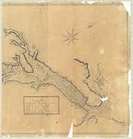
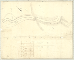
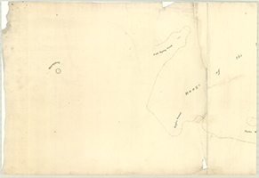
Book 18, page f "Map [and Profile] of Conemaugh River Near Saltsburg. Showing the fall, width, and amount of obstruction of stream alleged to have caused, at the flood of Feb. 9th. 1832, the destruction of Salt Owned by Barker, Royer, Arts & Dobbins." By John White, Engineer, 1840. Shows: Canal, Royer's Salt Works, Arts & Dobbin's Salt Works, Barker's Salt Works. (2 sections) |
  |
Book 18, page g [For upper gate of Guard Lock, Susquehanna], n.d. (see: "z" below) (2 sections) |
  |
Book 18, page h "Proposed Junction of the Pennsylvania & Susquehanna Canals," n.d. Shows: Columbia, Columbia Bridge, Collector's Office, Col. & Phila. R.R., Inclined Plane, Double Lock, Strickler's Saw Mill, Road to Washington, Proposed Mound, Penna. Canal, Outlet Lock, Basin. (2 sections) |
  |
Book 18, page i "Plan of a Mitre Sill, Susquehanna," n.d. (2 sections) |
  |
Book 18, page j "Map of the lines of Public Improvements of the State of Pennsylvania," n.d. Shows: Penna. Canal, Portage Rail Road, Penna. Road, M. & C. Rail Road, Delaware Division. (2 sections) |
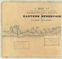  |
Book 18, page k "A Map of S. Branch of Juniata River Surveyed with a view to Location of Eastern Reservoir," By Wm. E. Morris, Civil Engineer, November 1839. Shows: Furnace, Saw Mill, Sett's Mill, Distillery, Turnpike, Newry, Dam, Feeder, Penna. Canal, Basin, Hollidaysburg. (2 sections) |
 |
Book 18, page l "Sketch of Proposed Extension of Canal at Head of the Tunnel Slack Water, Westn. Div. Pa. Canal," July 1840. Shows: Estimated cost of moving locks, Proposed Canal, Proposed Outlets, Present Outlets. (1 section) |
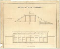  |
Book 18, page m "Wasteweir in Feeder, Eastern Reservoir, Stop Gates in Feeder, Eastern Reservoir," Wm. E. Morris, Civil Engineer. Exhibited at Letting, March 10th. 1846. (2 sections) |
 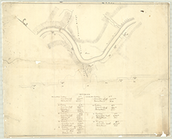 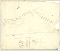  |
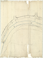
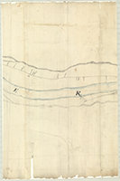
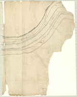
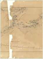
Book 18, page n [Map and Profile of the Conemaugh River showing Dams, Locks and Estimate for Sections Nos. 1, 6, 12, 17], n.d. (4 sections) |
   |
Book 18, page o [Ink and pencil drawing of a Turnpike Road passing Revd. Scraggs], n.d. Shows: Plan of a town, Old Furnace. see: "s" below for end section. (3 section) |
  |
Book 18, page p [Line of the Gettysburg Extension of the Pennsylvania Railroad], n.d. (2 sections) |
   |
Book 18, page q "Routes of the Gettysburg and Maryland Rail Road." Drawn by H. Houpt, P. Assistant. John P. Baily, Engineer, Oct. 31st. 1836. Shows: Profile, Exp. Line, Located Line, Waynesburg, Hagerstown. Vignette: Engine coming out of tunnel. (3 sections) |
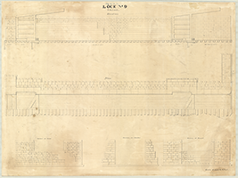 |
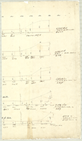
Book 18, page r "Lock No. 9," n.d. Shows: Elevation, Plan, Section at head, Section in chamber, Section at Breast. (1 section) |
 |
Book 18, page s [End section of "o" above, which see]. (1 section) |
 |
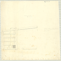
Book 18, page t "Plan of a town gate for Lock No. 2," n.d. (1 section) |
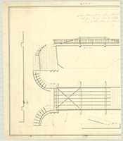 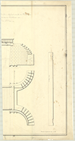 |
Book 18, page u "The following plan is for a Road Bridge - 16 feet wide in the Clear & the farm Bridge will be 12 feet wide in the clear - requiring 6 Strong piers less than this plan," n.d. (2 sections) |
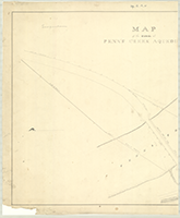 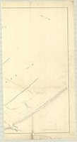 |
Book 18, page v "Map of the Canal at Penn's Creek Aqeduct," n.d. Shows: Aqueduct, Site for new Aqueduct, Bridge. (2 sections) |
 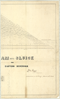 |
Book 18, page w "Dam and Sluice for Eastern Reservoir," Wm. E. Morris, Civil Engineer. Exhibited at Letting, March 10th 1846. (2 sections) |
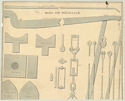  |
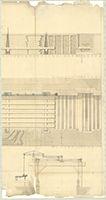
Book 18, page x "Irons for Weigh-Lock," n.d. by Franks. (2 sections) |
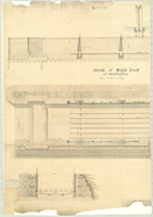  |
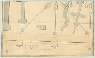
Book 18, page y "Sketch of Weigh Lock at Huntingdon." (2 sections) |
  |
Book 18, page z [For Upper gate of Guard Lock, Susquehanna], n.d. (see: "g" above). (2 sections) |
  |
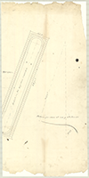
Book 18, page a-1 [Drawings for P. Ditches Nos. 1-4, Slate & Gravel Ditch 16 ft. wide on Susquehanna Division], n.d. (2 sections) |
 |
Book 18, page b-1 [Drawings for gate for Walls on Susquehanna Division], n.d. |
  |
Book 18, page c-1 [Drawings of a pattern for stones at end of Abutment on Susquehanna Division], n.d. (2 sections)
|