Pennsylvania Canal Maps
Map Book #25
|
Please
select a map tile to view larger version (individual tiles are PDF
files, approximately 1-2 MB in size)
|
|
Book 25, page 00 Index. (1 section) |
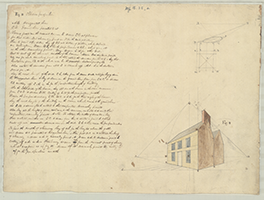 |
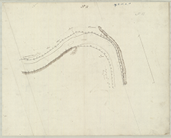
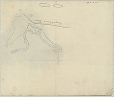
Book 25, page a [Drawing for Toll House?], n.d. (1 section) |
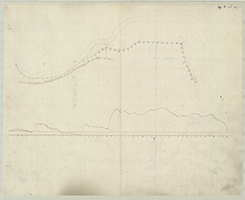 |
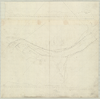
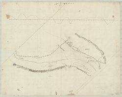
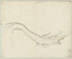
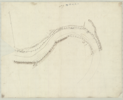
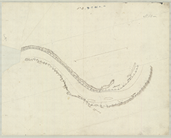
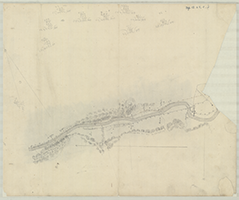
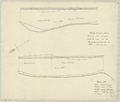
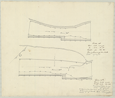
Book 25, page b [Map and Profile for a Canal along the North Branch from avobe the New York state line to below Terry Town (Wyalusing), n.d. John Randell, Engineer]. [Plan Showing River, Profile and proposed Canal], n.d. (1 section) |
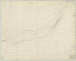 |
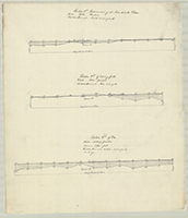
Book 25, page b No. 1 [Map and Profile for a Canal along the North Branch from avobe the New York state line to below Terry Town (Wyalusing), n.d. John Randell, Engineer]. [From New York State line to beyond Cayuta Creek, New York State], n.d. (1 section) |
 |
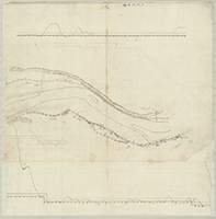
Book 25, page b No. 1 [Map and Profile for a Canal along the North Branch from avobe the New York state line to below Terry Town (Wyalusing), n.d. John Randell, Engineer]. [From 65 mile Stone, State Line to beyond Tylers], n.d. Shows: Saw Mill, Post Road. (1 section) |
 |
Book 25, page b No. 2 [Map and Profile for a Canal along the North Branch from avobe the New York state line to below Terry Town (Wyalusing), n.d. John Randell, Engineer]. [From Athens and beyond], n.d. (1 section) |
|
|
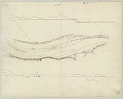
Book 25, page b No. 3 [Map and Profile for a Canal along the North Branch from avobe the New York state line to below Terry Town (Wyalusing), n.d. John Randell, Engineer]. [From Kingsbury's to Shaws], n.d. Shows: Road. (1 section) |
 |
Book 25, page b No. 4 [Map and Profile for a Canal along the North Branch from avobe the New York state line to below Terry Town (Wyalusing), n.d. John Randell, Engineer]. [From Gore's to Delpuch's], n.d. Shows: Road, Smith's Mill. (1 section) |
 |
Book 25, page b No. 5 [Map and Profile for a Canal along the North Branch from avobe the New York state line to below Terry Town (Wyalusing), n.d. John Randell, Engineer]. [From Shore's to Mill Run], n.d. Shows: Road. (1 section) |
 |
Book 25, page b No. 6 [Map and Profile for a Canal along the North Branch from avobe the New York state line to below Terry Town (Wyalusing), n.d. John Randell, Engineer]. [From before to beyond Towanda], n.d. Shows: Road. (1 section) |
 |
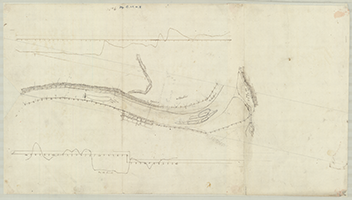
Book 25, page b No. 7 [Map and Profile for a Canal along the North Branch from avobe the New York state line to below Terry Town (Wyalusing), n.d. John Randell, Engineer]. [From Sickler's? to Wysox Creekk], n.d. Shows: Cole's Ferry. (1 section) |
 |
Book 25, page b No. 8 [Map and Profile for a Canal along the North Branch from avobe the New York state line to below Terry Town (Wyalusing), n.d. John Randell, Engineer]. [From York's to beyond Judge Stevens], n.d. (1 section) |
 |
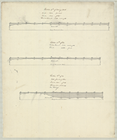
Book 25, page b No. 9 [Map and Profile for a Canal along the North Branch from avobe the New York state line to below Terry Town (Wyalusing), n.d. John Randell, Engineer]. [From Quail's Creek to beyond Laport], n.d. Shows: Roads. (1 section) |
 |
Book 25, page b No. 10 [Map and Profile for a Canal along the North Branch from avobe the New York state line to below Terry Town (Wyalusing), n.d. John Randell, Engineer]. [From beyond Shoemakers'], n.d. (1 section) |
 |
Book 25, page b No. 11 [Map and Profile for a Canal along the North Branch from avobe the New York state line to below Terry Town (Wyalusing), n.d. John Randell, Engineer]. [From Bird's to Terry Town (Wyalusing)], n.d. Shows: Road. (1 section) |
 |
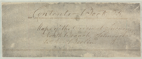
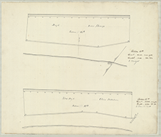
Book 25, page c "Maps of the Original Surveys. Upper North Branch, Selinsgrove to New Berlin], n.d. Cover. (1 section) |
 |
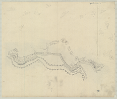
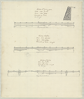
Book 25, page c [1.] "Maps of the Original Surveys. Upper North Branch, Selinsgrove to New Berlin," n.d. [From new Berlin to Mourer's Mill], n.d. |
 |
Book 25, page c [2.] "Maps of the Original Surveys. Upper North Branch, Selinsgrove to New Berlin," n.d. [From Miller's to Saw Mill], n.d. (1 section) |
 |
Book 25, page c [3.] "Maps of the Original Surveys. Upper North Branch, Selinsgrove to New Berlin," n.d. [From Ritter's to Richter's Mill], n.d. (1 section) |
 |
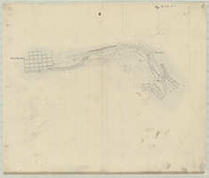
Book 25, page c [4.] "Maps of the Original Surveys. Upper North Branch, Selinsgrove to New Berlin," n.d. [To Selins Grove], n.d. Shows: Penna. Canal. (1 section) |
 |
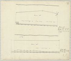
Book 25, page d (cover) [Profiles for a Canal and Towing Path on the West Side (of the North Branch) of the Susquehanna River, from Nanticoke Dam to Tobie's Creek, on towards Wilkes Barre, n.d. By Matthew Stealey, c. 1830-1831]. |
    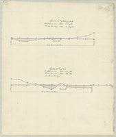 |
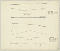
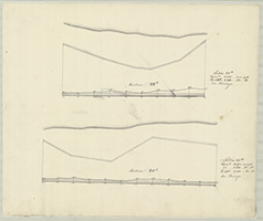
Book 25, page d (sections 1-5) [Profiles for a Canal and Towing Path on the West Side (of the North Branch) of the Susquehanna River, from Nanticoke Dam to Tobie's Creek, on towards Wilkes Barre, n.d. By Matthew Stealey, c. 1830-1831]. (19 sections) |
     |
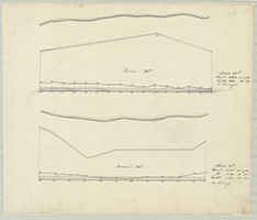
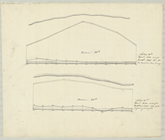
Book 25, page d (sections 6-10) [Profiles for a Canal and Towing Path on the West Side (of the North Branch) of the Susquehanna River, from Nanticoke Dam to Tobie's Creek, on towards Wilkes Barre, n.d. By Matthew Stealey, c. 1830-1831]. (19 sections) |
 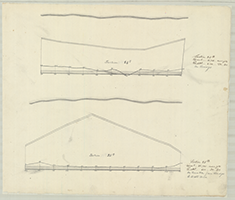    |
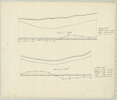
Book 25, page d (sections 11-15) [Profiles for a Canal and Towing Path on the West Side (of the North Branch) of the Susquehanna River, from Nanticoke Dam to Tobie's Creek, on towards Wilkes Barre, n.d. By Matthew Stealey, c. 1830-1831]. (19 sections) |
 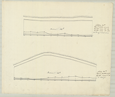   |
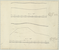
Book 25, page d (sections 16-19) [Profiles for a Canal and Towing Path on the West Side (of the North Branch) of the Susquehanna River, from Nanticoke Dam to Tobie's Creek, on towards Wilkes Barre, n.d. By Matthew Stealey, c. 1830-1831]. (19 sections) |