Pennsylvania Canal Maps
Map Book #2
|
Please
select a map tile to view larger version (individual tiles are PDF
files, approximately 1-2 MB in size)
|
|
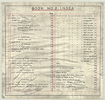
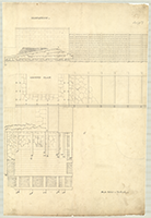
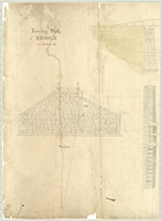
Book 02, page 00 Index. (1 section) |
|
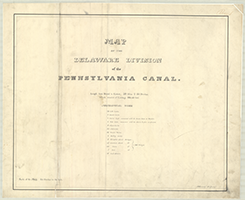
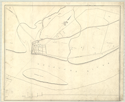
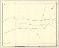
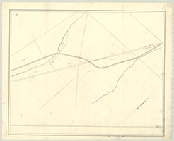
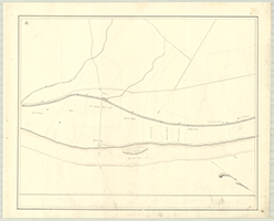
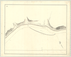
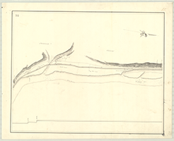
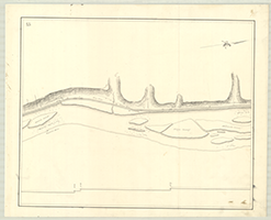
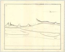
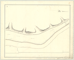
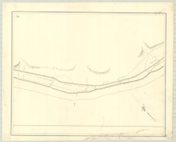
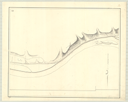
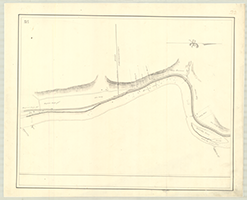
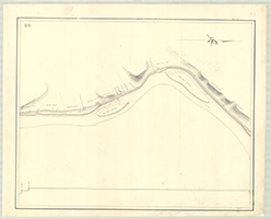
Book 02, pages 01, 02, 03, 04 [from left to right] (01) "Map of the Delaware Division of the pennsylvania Canal, Length from Bristol to Easton, 59 Miles & 60 Perches. Whole amount of Lockage, 165.05 feet," n.d. A. W. Kennedy, Draftsman. (1 section) (02) [Bristol, Mill Pond, Burlington Island, Turnpike Rd.], n.d. (1 section) (03) [Tully Town, Turnpike Rd.], n.d. (1 section) (04) [Tyburn, Mill Pond, Turnpike Rd.], n.d. (1 section) |

|
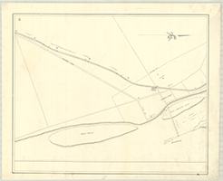
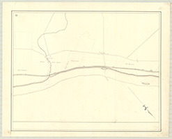
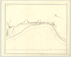
Book 02, page 05, 06, 07, 08 [from left to right] (05) [Morris Ville, Bird's or Morrisville Island, Moon's Island, Turnpike Rd.], n.d. (1 section) (06) [Falls and Lower Makefield, Ferry], n.d. (1 section) (07) [Yardley Ville, Ferry], n.d. (1 section) (08) [Hough's Creek, Harvey's, Duer's Slack's Islands, Scudder's Falls], n.d. (1 section) |
    |
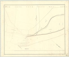
Book 02, page 09, 10, 11, 12 [from left to right] (09) [Taylors Ville, Lownis Island, Samuel Yardley, Ferry], n.d. (1 section) (10) [Browns-burg, John Beaumont's, Stout's Island], n.d. (1 section) (11) [Lewis S. Coryell, Dark Hollow, Pidcock's Creek, Neely's Creek, Smith's Island, Ferry], n.d. (1 section) (12) [New Hope, Lamberts-ville, to S. & M. Pownalls], n.d. (1 section) |
    |
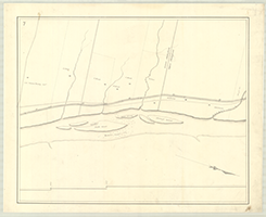
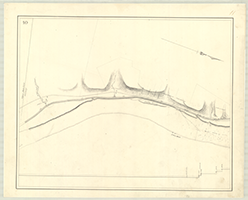
Book 02, page 13, 14, 15, 16 [from left to right] (13) [Paxson's Island, Eagle Island, Centre Bridge], n.d. (1 section) (14) [Lumber-ville, Bull's Island and Falls], n.d. (1 section) (15) [Tumbling Dam, Tohickon Creek, Point Pleasant, Ferry], n.d. (1 section) (16) [Marshall's, Ridge's Rush and Gondale Islands, Smithville, Ferry], n.d. (1 section) |
    |
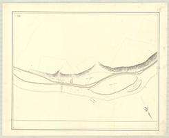
Book 02, page 17, 18, 19, 20 [from left to right] (17) [Marshall's Island, Tinicum Creek, Penington & Fish Islands, Button Wood Falls, Man of War Island & Falls], n.d. (1 section) (18) [Etwinna to Henry Sigafoos], n.d. (1 section) (19) [Cove Run, Black's Eddy, Ferry], n.d. (1 section) (20) [Gallon's Run, Nockamixon Narrows, Lynn's Falls & Island, Ferry], n.d. (1 section) |
   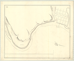 |
Book 02, page 21, 22, 23, 24 [from left to right] (21) [Monroe Creek, Durham Creek, Ferry], n.d. (1 section) (22) [Ground Hog Island & Falls, Rocky Falls, Ferry], n.d. (1 section) (23) [Old Sow Island], n.d. (1 section) (24) [Easton, Feeder Dam, Whippoorwill Creek], n.d. (1 section) |
  |
Book 02, page 26 "Gates etc., of Lock of 9. Ft. Lift," n.d. (2 sections) |
  |
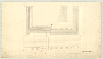
Book 02, page 27 "Dam No. 2. Plan drawn by Mr. Morgan. Dam as being built when I took charge of the work," n.d. (2 sections) |
 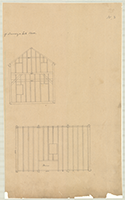 |
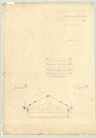
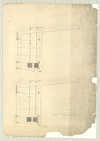
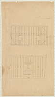
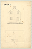
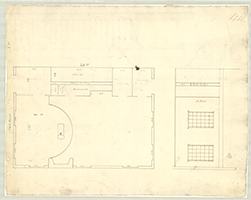
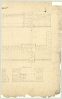
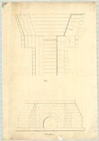
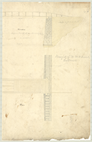
Book 02, page 28 "Plan of Framing a Lock House," n.d. (2 sections) |
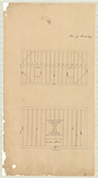 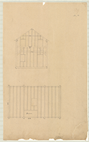 |
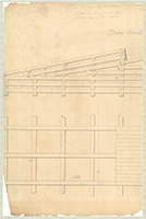
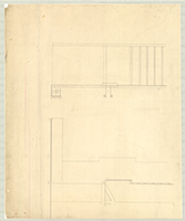
Book 02, page 29 "Plan of Framing" [a lock house], n.d. (2 sections) |
 |
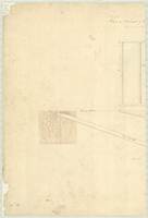
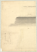
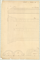
Book 02, page 30 "Culvert. on Section No. 32, End View & Section at Centre," n.d. (1 section) |
  |
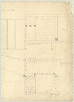
Book 02, page 31 "Guard-Gate on Sections No. 7 and 30. Elevation," n.d. (2 sections) |
 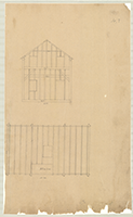 |
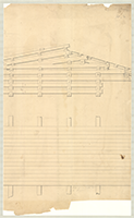
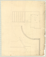
Book 02, page 32 "Plan for Framing" [a Lock House], n.d. (2 sections) |
  |
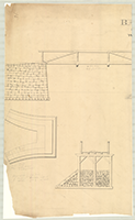
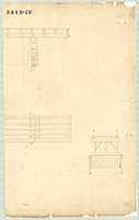
Book 02, page 33 "Road Bridge over Millrace at Wyalusing," n.d. (2 sections) |
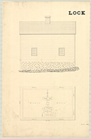  |
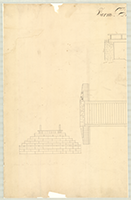
Book 02, page 34 "Lock House," n.d. (2 sections) |
  |
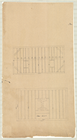
Book 02, page 35 [Plan?], n.d. (2 sections) |
 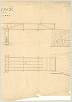 |
Book 02, page 36 "Bridge Over Wysox," n.d. |
  |
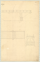
Book 02, page 37 "Tenon of Mitre Brace," n.d. (2 sections) |
  |
Book 02, page 37 1/2 "Plan of Breast of Lock of 9 ft. Lift," n.d. (reverse side of p. 37) |
  |
Book 02, page 38 "Culvert over Rummerfield's Creek on Sec. 44," n.d. (2 sections) |
  |
Book 02, page 39 "Circumfluent, Lock XI," n.d. (2 sections) |
 |
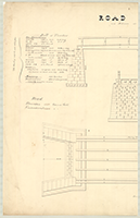
Book 02, page 40 "Plan for constructing Road past Sections 20, 21 & 22. Exhibited at Letting at Towanda, January 26, 1839." (1 section) |
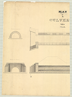  |
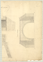
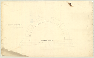
Book 02, page 41 "Plan of a Culvert VIII ft. Chord," n.d. (2 sections) |
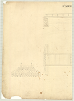  |
Book 02, page 42 "Farm Bridge," n.d. (2 sections) |
 |
Book 02, page 43 1/2 [Culvert] "10 Feet Chord," n.d. (reverse side of 43) |
 |
Book 02, page 44 [Plan?], n.d. (1 section) |
  |
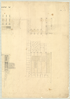
Book 02, page 45 "Culvert on Section 32," n.d. (2 sections) |
  |
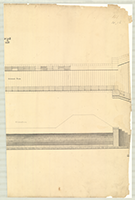
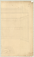
Book 02, page 46 "Lift Lock IX Ft. Elevation," n.d. (2 sections) |
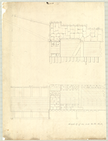  |
Book 02, page 47 "Lock and Feeder," n.d. (2 sections) |
  |
Book 02, page 48 [Culvert] "4 Feet Chord," n.d. (2 sections) |
  |
Book 02, page 49 "Farm Bridge," n.d. (2 sections) |
 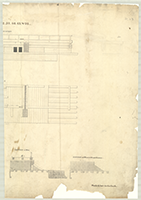 |
Book 02, page 50 "Waste-Weir on Secs. Nos. 12, 15, 22, 34, 40, 43 & 52. Exhibited at the Letting at Towanda, January 26, 1837." (2 sections) |
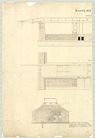 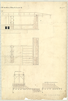 |
Book 02, page 51 "Waste-Weir on Secs. Nos. 4, 5 and 6. Elevations. Exhibited at the Letting at Towanda, January 26, 1837. Also at Letting August 17th 1838." (2 sections) |
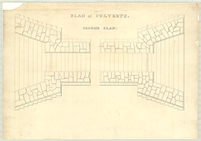 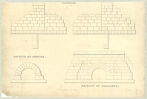 |
Book 02, page 52 "Plan of Culverts. Ground Plan, Elevation, Section at Centre, Section at Parapets." Exhibited at the Letting at Towanda October 25th. 1836-Exhibited at Towanda January 26, 1837. Also, June 4th. 1838. Also, August 17, 1838. (2 sections) |
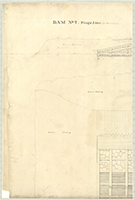  |
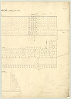
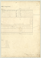
Book 02, page 53 "Dam No. 2: Tioga Line. (at Towanda)," n.d. Shows: Elevation, Ground Plan, Gravel Filling. (2 sections) |
  |
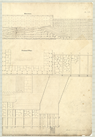
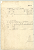
Book 02, page 54 "Dam No. 1. Tioga Line," n.d. Shows: Elevation, Gravel Filling, Ground Plan. (2 sections) |
  |
Book 02, page 55 "Guard-Lock: Tioga Line," n.d. Shows: Elevation, Plan, Section (2 sections) |
  |
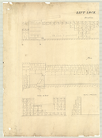
Book 02, page 56 "Lift-Lock: Tioga Line," n.d. Shows: Elevation, Plan, Section. (2 sections) |
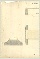  |
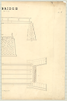
Book 02, page 57 "Public Bridge," n.d. Shows: Elevation, Plan, Section of Abutment, Section of Pier. (2 sections) |
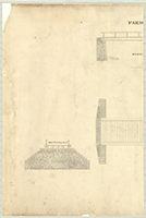  |
Book 02, page 58 "Farm Bridge," n.d. Shows: Elevation, Plan, Section of Abutment, Section of Pier. (2 sections) |
  |
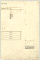
Book 02, page 59 "Towing Path Bridge on Section 26," n.d. Shows: Elevation, Plan, Section. (2 sections) |