Pennsylvania Canal Maps
Map Book #4
|
Please
select a map tile to view larger version (individual tiles are PDF
files, approximately 1-2 MB in size)
|
|
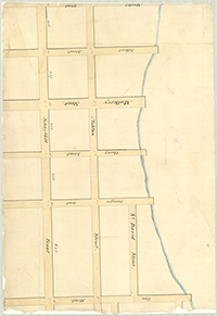
Book 04, page 00 Index. (1 section) |
|
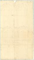
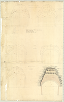
Book 04, page 01 [Drawings for Arches of brick, timber, etc.], n.d. (2 sections) |
|
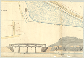
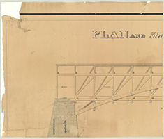
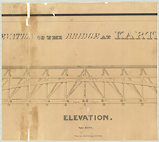
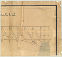
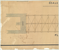
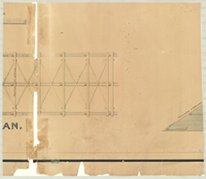
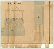
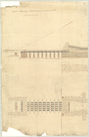
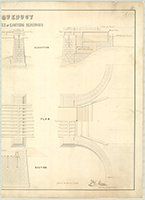
Book 04, page 02 "Plan and Elevation of the Bridge at Karthus." Charles L. Schlatter, Principal Engineer, harrisburg. June 5th. 1840. Shows: Piers, Abutments. (6 sections) |
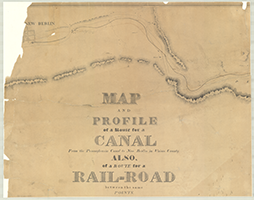 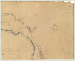  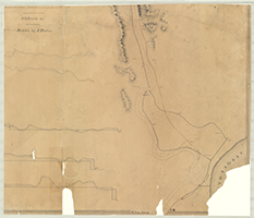 |
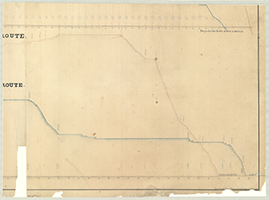
Book 04, page 03 "Map and Profile of a Route for a Canal From the Pennsylvania Canal to New Berlin in Union County. Also, of a Route for a Rail-Road between the same Points," n.d. J. D. Harris, Engr. Drawn by J. Paxton. (4 sections) |
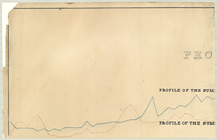 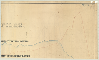 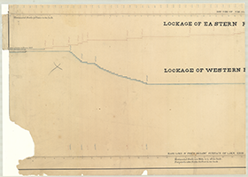  |
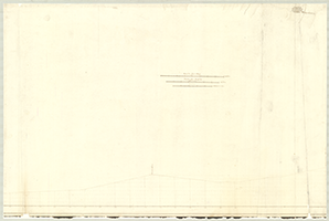
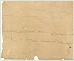
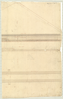
Book 04, page 04 "Profiles." Profiles of the summits of Eastern and Western Routes. Lockage of Eastern and Western Routes. Drawn by Edward Theirry, Eng: & Draftsman. Novbr. 1836. (4 sections) |
  |
Book 04, page 05 "Sketch of Masonry of Western Reservoir previous to 1851." (2 sections) |
    |
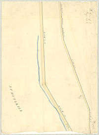
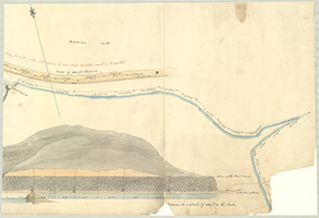
Book 04, page 06 [Drawing for a Lockage into a Canal from a Stream at Northumberland?] (4 sections) |
|
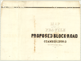
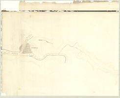
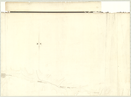
Book 04, page 07 "Map and Profile of the Proposed Block-Road from Chambersburg to Pitssburg," Charles De Hass, P. Engr. 1838. (8 sections) |
|
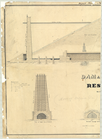  |
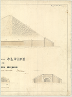
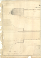
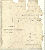
Book 04, page 08 "Dam and Sluice for Reservoirs by Wm. E. Morris, Civil Engineer, 1839." Original Plan No. 1. Shows: Views of upper and lower ends of Culvert, section through center. (2 sections) |
  |
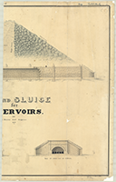
Book 04, page 09 "Dam and Sluice for Western Reservoir , Wm. E. Morris, Civil Engineer." Exhibited at Letting, March 10th. 1846. (2 sections) |
|
|
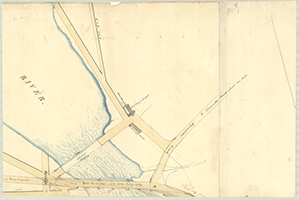
Book 04, page 10 [Survey by Wm. Strickland, March 5th-1829, of plans looking to a Bridge across the Schuykill River below Fairmount Dam.] Approved by Samuel Hains, City Surveyor and Jas. H. Siddale, Surveyor of N. Liberties. (8 sections) |
  |
Book 04, page 11 "Aqueduct For Feeder at Eastern Reservoir, by Wm. E. Morris, Civil Engineer," n.d. Shows: Elevation, Plan, Section. Exhibited at Letting, March 10th. 1846. (2 sections) |
 |
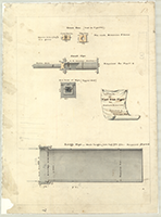
Book 04, page 12 "Sketch of Piling Iron [for] Western Reservoir," n.d. Shows: Front Elevation. (1 section) |
 |
Book 04, page 13 "Plan of Cast Iron Pipes for Eastern Reservoir. Furnished to Contractors, April 24th. 1840. (1 section) |
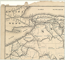 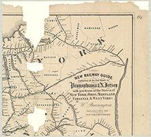 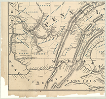 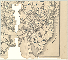 |
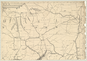
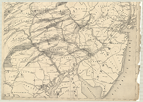
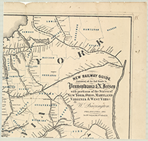
Book 04, page 14 "New Railway Guide Containing all of the Rail Roads in Pennsylvania & N. Jersey with portions of the States of New York, Ohio, Mayland, Virginia & West Virginia By W. Barrington." Philadelphia, 1866. Jas. McGuigan, Lith. 3rd & Dock St. (4 sections) |
|
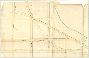
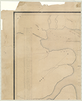
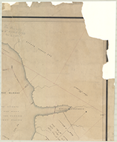
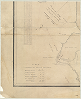
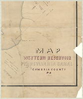
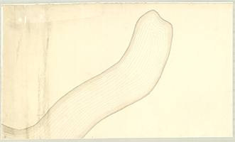
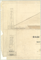
Book 04, page 15 "Map of the Western Reservoir For Pennsylvania Canal, Cambria County, Pa., 1853." R. S. Alexander. (4 sections) |
|
  |
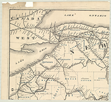
Book 04, page 16 [Iron, Railroad, Canal & Coal Map of Pennsylvania with parts of Maryland, New York, New Jersey, Ohio, Virginia & West Virginia], n.d. (2 sections) |
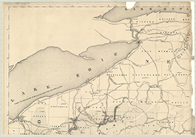  |
Book 04, page 17 [Iron, Railroad, Canal & Coal Map of Pennsylvania with parts of Maryland, New York, New Jersey, Ohio, Virginia & West Virginia], n.d. (2 sections) |
  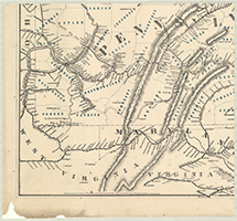 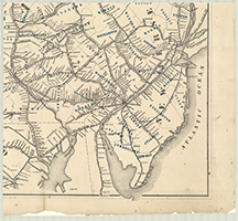 |
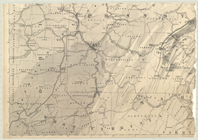
Book 04, page 18 "New Railway Guide Containing all the Rail Roads in Pennsylvania & N. Jersey with portions of the States of New York, Ohio, Maryland, Virginia & West Virginia. By W. Barrington." Philadelphia, 1866. Jas. McGuigan, Lith. 3rd & Dock St. (4 sections) |
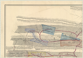 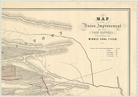 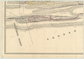 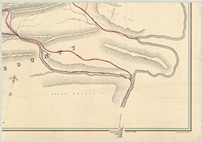 |
Book 04, page 19 "Map of the Union Improvement and other Coal Estates in the N. E. Section of the Middle Coal Field," n.d. P. S. Duval & Co's Lith. Phiadelphia. (4 sections) |
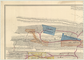 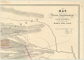 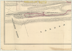 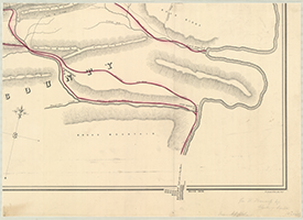 |
Book 04, page 20 "Map of the Union Improvement and other Coal Estates in the N.E. Section of the Middle Coal Field,: n.d. P. S. Duval & Co's Lith. Philadelphia Geo. W. Hamserly, Esq. Clerk of Senate, Harrisburg. From A. S. Roberts. (4 sections) |