Mansfield
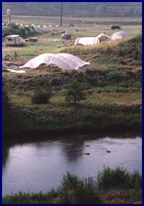
The Mansfield Bridge site (36TI116) is located on the floodplain of the Tioga River. Excavations at the site took place as part of the Pennsylvania Department of Transportation (PennDOT) relocation of State Route 6015. Because the site was repeatedly flooded over during the last 10,000 years, prehistoric occupations were stratified, or layered, with Middle Archaic deposits at the bottom and a Late Woodland village at the top. An area of over 5600 square feet (525 square meters) was excavated. Shelters were placed over the excavation blocks to protect them from weather damage.
Three Archaic period occupations were found at the site, each of which appears to have represented a short-term camp. All had tools for cracking nuts such as beechnuts and butternuts. Evidence of fire pits and surface fires were found, but they did not appear to have been reused, as would be the case during a longer-term encampment. During the Archaic period the site was likely occupied by small groups of related families who moved their camps periodically to be close to the food and other resources they needed.
The most extensive occupation of the site took place around AD 1060, during the Late Woodland period. A pattern of posts was found, revealing a well-defined house pattern that was undoubtedly part of a larger occupation. Typically, from this time period, small hamlets or farmsteads consisting of less than four houses are the rule. However, PennDOT was responsible only for excavating within their right-of-way, and we do not know the number of houses in this occupation. Inside the house were five evenly spaced storage features, along with centrally located fire pits. The storage pits were likely used for corn or nuts. There is evidence to suggest that Late Woodland people also grew seed plants such as knotweed or pigweed, which originally grew wild but eventually became a domesticated crop. Tools found at the site included stones for grinding corn and seeds into flour.
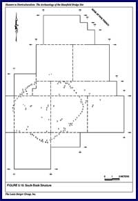
The house measured 27 x 25 feet with a gap in the east wall, considered to be the entrance. Interior posts for structural support were also present. We assume that the residence contained an extended nuclear family.
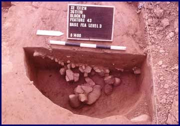
This feature is a large silo-like pit with a large concentration of ceramics, likely representing storage containers. One ceramic pipe stem fragment was also found in the feature. Charcoal from the fill produced a radiocarbon date of 890± 100 BP, or approximately AD 1060.
PennDOT sponsored an extensive public outreach program that included training, education, and first-hand experience for the members of Boy Scout Troop 21 in order to help them meet the requirements for a merit badge in archaeology. Twenty-two scouts worked at the site alongside the archaeologists and a member of the Oneida tribe who consulted on the project.
Acknowledgements
Archaeological investigations at the site were sponsored by the Pennsylvania Department of Transportation and the Federal Highway Administrations. The work was conducted by the Louis Berger Group, Inc. Photographs were provided by Robert Wall, Principal Investigator for the project.