Create Smart Maps
The database can be linked in a static manner or "live" directly to the digital map. The GIS is not limited to a linkage with one database. Layers of both current and historic information can be created and added as additional database tables. A GIS of community cemeteries could zoom down to one site, or show a map of the whole community with each site highlighted.
In the samples shown below, the database is linked to the GIS maps through the layer of the site and cemetery plots allowing specialized "smart" maps to be generated to show spatial organization, landscape features, dates, conditions, and combinations of all types of information collected. For example, queries can be defined to show all markers of a specific material that are in the worst shape based on a specific condition. Maps of emergency conditions can be generated to prioritize preservation needs.
The data-linked maps provide powerful analytical capabilities, and can also enhance the generation of creative presentations for project discussions, funding proposals, and educational programs. On a website, the database-linked maps aid family members, genealogists, and other researchers to locate markers, as seen in the Tomb Search example.
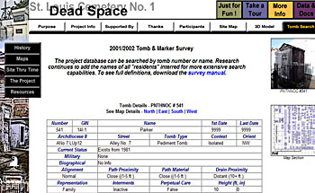 |
| Example of Cemetery Tomb Search |
 |
| Distribution by First Death Date (click to enlarge) | |
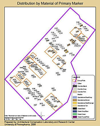 |
| Distribution by Material of Marker (click to enlarge) | |
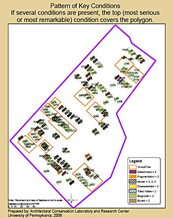 |
| Distribution of Key Conditions (click to enlarge) | |
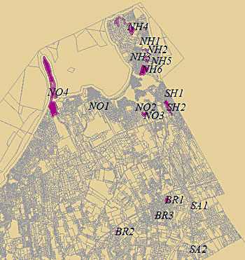 |
| Cemetery layout (click to enlarge) | |