Pennsylvania Canal Maps
Map Book #19
|
Please
select a map tile to view larger version (individual tiles are PDF
files, approximately 1-2 MB in size)
|

|
Book 19, page 00 Index. (1 section) |
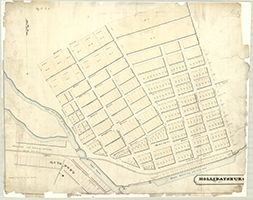 |
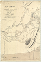
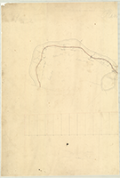
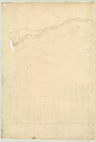
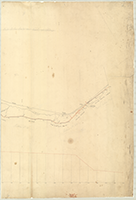
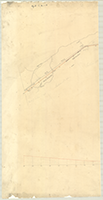
Book 19, page a [Map of] "Hollidaysburg and Gaysport," 1840. Shows: Penna. Canal, Allegheny Portage R.R., Weigh Lock, Phila. & Pittsburg Turnpike. (1 section) |
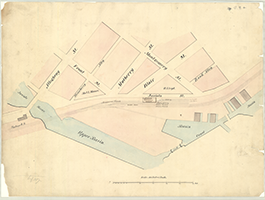 |
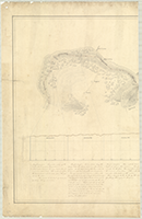
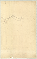
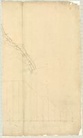
Book 19, page b [Map of Gaysport], n.d. Shows: Portage R.R., Canal Basins, Lock. (1 section) |
 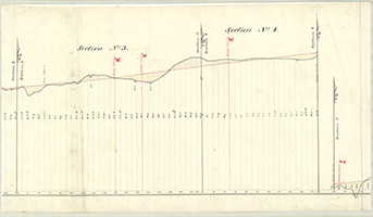   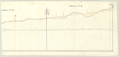 |
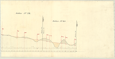
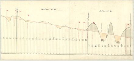
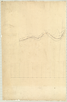
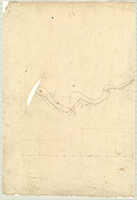
Book 19, page c-f [Profiles, New Allegheny Portage Rail Road], n.d. Sections 1-5. |
     |
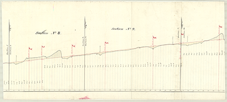
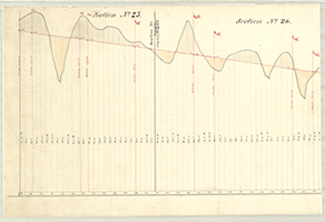
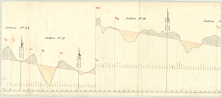
Book 19, page c-f [Profiles, New Allegheny Portage Rail Road], n.d. Sections 6-10. |
 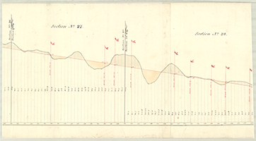   |
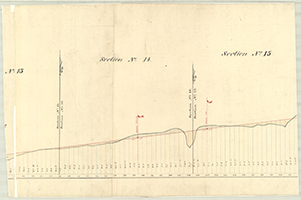
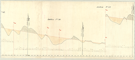
Book 19, page c-f [Profiles, New Allegheny Portage Rail Road], n.d. Sections 11-14. |
   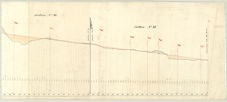 |
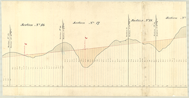
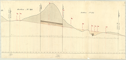
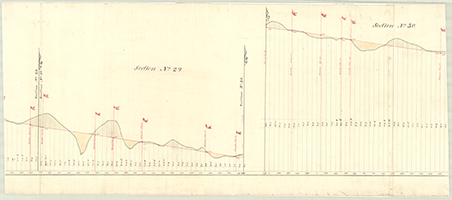
Book 19, page c-f [Profiles, New Allegheny Portage Rail Road], n.d. Sections 15-18. |
 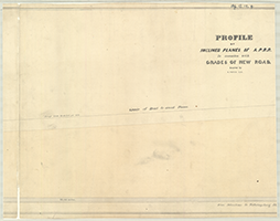 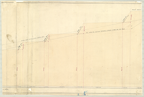 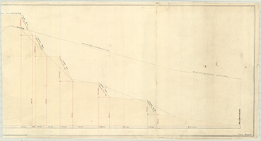 |
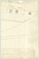
Book 19, page g "Profile of Inclined Planes of Allegheny Portage Rail Road In connection with grades of New Road, Located by R. Faries, C.E.," n.d. (4 sections) |
  |
Book 19, page h [Map and Profile Showing Locations of the Pilot Line, the Baltimore Line, and of tracks and Canal Basin at Hollidaysburg], for a lateral Railway of Garber Jackson and others to connect with the Portage Railway along the basin at Gaysport. Johnstown, August 1834. John A. Roebling. (2 sections) |
  |
Book 19, page i "Plan and Profile of the Allegeny Mountain between the head waters of Blair's Creek, a branch of the Juniata, and the mountain branch of the Conemaugh with the proposed Tunnel Line connecting the two streams; and the Reservoir and Feeders. State of Pennsylvania, 1824." Jacob Holgate, Charles Treziyulny. Shows: Tunnel Line, Routes of the Level and Survey, Routes of Feeders to Tunnel, Roads. (2 sections) |
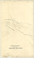  |
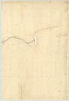
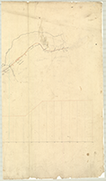
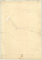
Book 19, page j "Connection with the Portage Railroad," n.d. Shows: Gaysport, Hollidaysburg, Basin, Turnpike to Pittsburgh, Waltersburg, Duncansville. (2 sections) |
  |
Book 19, page k-1 "Plans Showing the Division of the Road into Sections" [of Allegheny Portage Railroad, by Sylvester Welch], n.d. [Johnstown, Section No. 1 to Section No. 7], n.d. Work Map. Shows: Inclined Plane, Tunnel. (2 sections) |
  |
Book 19, page k-2 "Plans Showing the Division of the Road into Sections" [of Allegheny Portage Railroad, by Sylvester Welch], n.d. [Section No. 8 to Section No. 13], n.d. Work Map. (2 sections) |
  |
Book 19, page [k-2] "Plans Showing the Division of the Road into Sections" [of Allegheny Portage Railroad, by Sylvester Welch], n.d. [Section No. 8 to Section No. 13], n.d. Profile and Map. (2 sections) |
  |
Book 19, page k-3 "Plans Showing the Division of the Road into Sections" [of Allegheny Portage Railroad, by Sylvester Welch], n.d. [Section No. 14 to Section No. 19], n.d. Work Map. Shows: Culverts. (2 sections) |
  |
Book 19, page k-5 (k-4 missing) "Plans Showing the Division of the Road into Sections" [of Allegheny Portage Railroad, by Sylvester Welch], n.d. [Section No. 26 to Section No. 32], n.d. Work Map. Shows: Inclined Planes Nos. 3-4, Culverts. (2 sections) |
  |
Book 19, page k-6 "Plans Showing the Division of the Road into Sections" [of Allegheny Portage Railroad, by Sylvester Welch], n.d. [Section No. 32 to Section No. 37], n.d. Work Map. Shows: Inclined Planes, Nos. 5-7, Culverts. (2 sections) |
  |
Book 19, page k-7 "Plans Showing the Division of the Road into Sections" [of Allegheny Portage Railroad, by Sylvester Welch], n.d. [Section No. 38 to Section no. 43], n.d. Work Map. Shows: Profile, Inclined Planes Nos. 8-10, Culverts. (2 sections) |
  |
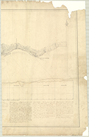
Book 19, page k-8 [Section No. 43 to Section No. 46, Hollidaysburg], n.d. Work Map. Shows: Profile, Culverts, Viaduct, Basin. (2 sections) |