Discovery Techniques
GPR (Ground Penetrating Radar)
Ground Penetrating Radar produces an underground cross-section image of soils and subsurface features. In the past, GPR has been used and is being considered as a tool for the detection of a wide variety of subterranean features. It has been used for the detection of buried tanks, landfill debris, examining of archeological sites as well as the detection of grave sites. For more information see these other websites:
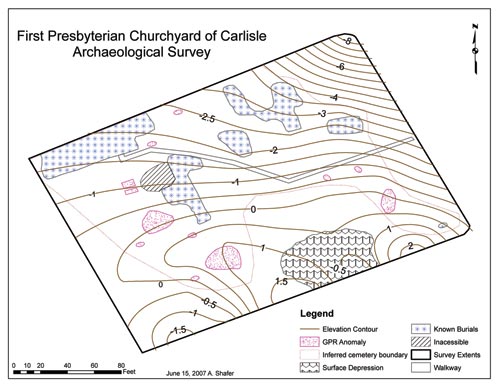 |
| Ground penetrating radar map of First Presbyterian Churchyard, Carlisle (click to enlarge) |