Establish the Location Site Map
Most counties and many communities in Pennsylvania now have a GIS department and have mapped streets, water bodies, and properties to the parcel level. Sometimes this information is available publicly, but more often it is available from the local government as needed for an acceptable use. A cultural resource survey of a historic cemetery normally would be considered an "acceptable use." Most communities are happy to share their GIS maps and spatial data files for such a purpose and may offer technical resources as well. There are also many good websites to visit for maps of the local area:
A good resolution aerial image of the cemetery boundary area will often show enough of the marker placements to draw a plot map directly over the aerial image. It is not usually the intent, or project need, that historic cemetery sites be mapped with millimeter accuracy. The maps are meant to provide general locations to future users, and to enable the mapping of materials and conditions for preservation planning.
In very large sites, the use of hand-held GPS units can be helpful to establish general locations, if a spatially referenced aerial image is not available. However, only very sophisticated GPS units are accurate enough to distinguish distances reliably between individual markers in a densely developed burial ground.
For those with direct access to GIS software, the site map can be made entirely digital. Layers of historic and current site information can be captured and digitized. Historic maps, USGS maps, aerial photographs, and local planning maps can be "rubber-sheeted" and geo-processed within the GIS.
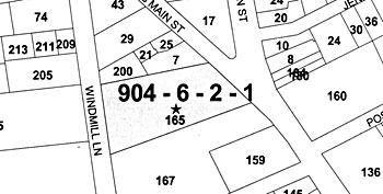 |
| Local Community GIS map |
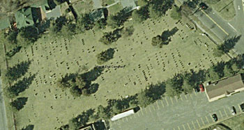 |
| Aerial view downloaded from PASDA |
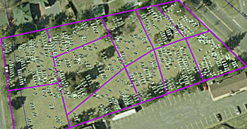 |
| Sections and plots digitized onto aerial |
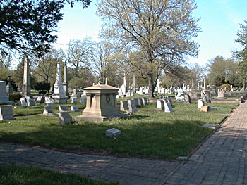 |
| Woodlands, Philadelphia |