Pennsylvania Canal Maps
Map Book #17
|
Please
select a map tile to view larger version (individual tiles are PDF
files, approximately 1-2 MB in size)
|
|
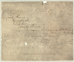
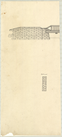
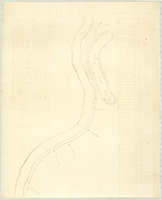
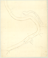
Book 17, page 00 Index. (1 section) |
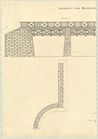 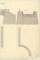 |
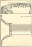
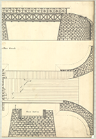
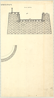
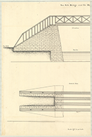
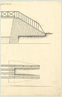
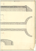
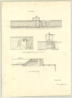
Book 17, page a "Aqueduct over Brightfield's Run," n.d. Shows: Elevation, Ground Plan, Cross Section. (2 sections) |
  |
Book 17, page b "Aqueduct ocer Kishicoquillas Creek," n.d. Shows: Elevation, Ground Plan, Cross Section. (2 sections) |
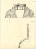  |
Book 17, page c "Aqueduct on Section 129," n.d. Shows: Elevation, Ground Plan, Cross Section. (2 sections) |
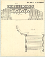  |
Book 17, page d "Aqueduct at Newton Hamilton," n.d. Shows: Elevation, Ground Plan, Cross Section. (2 sections) |
 |
Book 17, page e "Aqueduct over Standing Stone Creek," n.d. Shows: Elecation, Cross Section. (1 section) |
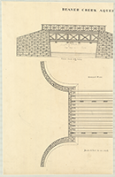  |
Book 17, page f "Beaver Creek Aqueduct," n.d. Shows: Elevation, Ground Plan, Cross Section. (2 sections) |
  |
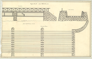
Book 17, page g "Works (Aqueduct) at Mill Creek," n.d. Shows: Cut for West Branch, Aqueduct. (2 sections) |
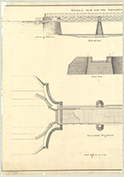  |
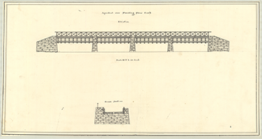
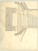
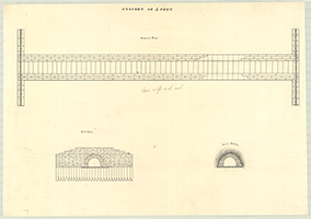
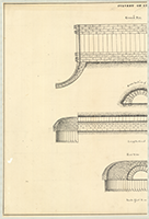
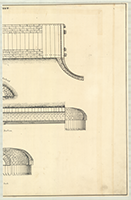
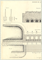
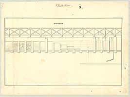
Book 17, page h "General Plan for the Aqueducts," n.d. Shows: Elevation, Cross View, Horizontal Projection. (2 sections) |
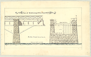 |
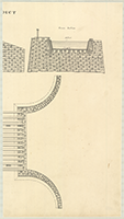
Book 17, page i "Plan of Kishacoquillas Aqueduct," n.d. Shows: Elevation, Cross Section. (1 section) |
 |
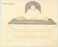
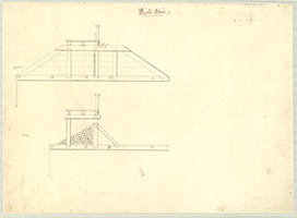
Book 17, page j "Plan for Aqueducts Nos. 1, 2 & 3. Aqueduct of 30 Feet Span," n.d. Shows: Section of Weir on Berm side. (1 section) |
 |
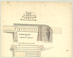
Book 17, page k "Aqueduct over Mill Creek," n.d. Shows: Elevation, Ground Plan, Cross Section. (1 section) |
  |
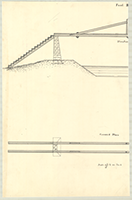
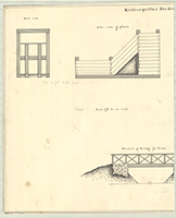
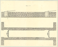
Book 17, page l "Tow Path Bridge over the Raystown Feeder," n.d. Shows: Elevation, Ground Plan. (2 sections) |
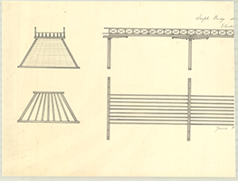  |
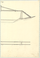
Book 17, page m "Trussle Bridge at North's Island," n.d. Shows: Elevation, Ground Plan. (2 sections) |
 |
Book 17, page n "Plan of Public Bridges at Waynesburg & Huntingdon," n.d. Rough Draft. (1 section) |
 |
Book 17, page o "Plan of Public Bridges at Waynesburg & Huntingdon," n.d. (1 section) |
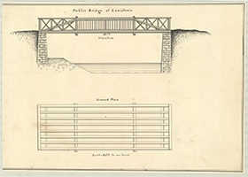 |
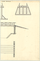
Book 17, page p "Public Bridge at Lewistown," n.d. Shows: Elevation, Ground Plan. (1 section) |
 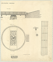 |
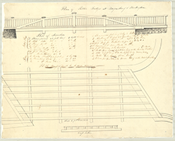
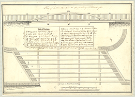
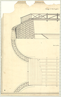
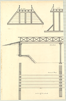
Book 17, page q "Swinging Bridge," n.d. Shows: Elevation, Ground Plan, Abutment, Pier, Wheel Path, Protection Pier, Bridge Frame, Wheel. (2 sections) |
 |
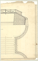
Book 17, page r "Bridge over Outlet Lock," n.d. Shows: Elevation, Criv, Lock, Ground Plan, Cross Section. (1 section) |
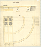 |
Book 17, page s "Swing Bridge," n.d. (1 section) |
 |
Book 17, page t "Plan of Tow Path Bridge and Raystown Feeder," n.d. (1 section) |
 |
Book 17, page u "Public Bridge," n.d. (1 section) |
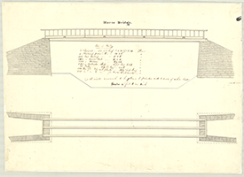 |
Book 17, page v "Horse Bridge," n.d. Shows: Bill of Timber. (1 section) |
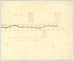 |
Book 17, page x "Tow Path & Road, Section No. 67," n.d. (1 section) |
 |
Book 17, page y [Tow Path and Bridge Abutment], n.d. (1 section) |
  |
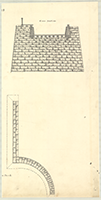
Book 17, page z "Bridge at Huntingdon," n.d. Shows: Elevation, Abutment. (2 sections) |
  |
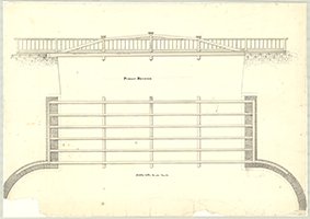
Book 17, page a-1 "Fool Bridge," n.d. Shows: Elevation, Ground Plan. (2 sections) |
  |
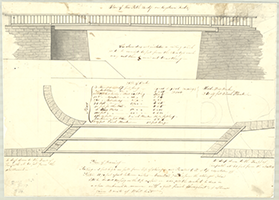
Book 17, page b-1 "Farm Bridge," n.d. Shows: Tow Path, Centre, Berm, Elevation, Ground Plan. (2 sections) |
 |
Book 17, page c-1 "Road from Perrysville to Turnpike and intersecting Canal road from Mifflin to Mexico. New Road Beginning at a pose and from a Walnut tree on bank of river No 55 degrees, E. 1.2 ps. thence-" n.d. Shows: Courses and distances, Canal. (1 section) |
  |
Book 17, page d-1 "Road commencing near the house of William Watson at the Poor Spring and connecting with the old road near the mouth of Big Buffalo Creek," n.d. Shows: Canal, Ferry. (2 sections) |
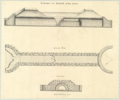 |
Book 17, page e-1 "Culvert at Smith's Mill Race," n.d. Shows: Elevation, ground Plan, End View. (1 section) |
  |
Book 17, page f-1 "Culvert over Holiday's Run," n.d. Shows: Elevation, Ground Plan, End View. (2 section) |
 |
Book 17, page g-1 "Culvert of 4 Feet," n.d. Shows: Ground Plan, End View, Cross Section. (1 section) |
  |
Book 17, page h-1 "Culvert of 8 Feet," n.d. Shows: Ground Plan, Cross Section, Longitudinal Section, End View. (2 sections) |
 |
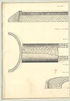
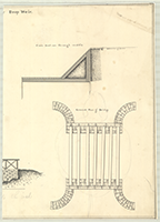
Book 17, page i-1 "Culvert of 8 ft. Span," n.d. Shows: Wing Walls, Cross Section. (1 section) |
 |
Book 17, page j-1 "Section of Dam at North's Island," n.d. (1 section) |
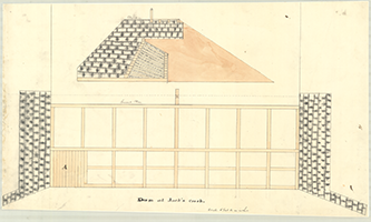 |
Book 17, page k-1 "Dam at Jack's Creek," n.d. Shows: Elevation, Ground Plan. (1 section) |
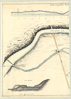 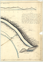 |
Book 17, page l-1 "Kishicoquillas Feeder - Section, No. 1," n.d. Shows: Dam, Cross Sections, Sluice, Mill Race. Description. (2 sections) |
  |
Book 17, page m-1 "Kishicoquillas Feeder Drop Weir," n.d. Shows: Back view, Side view of plank, Cross Section through middle, Elevation of Bridge for Feeder, Ground Plan of Bridge. (2 sections) |
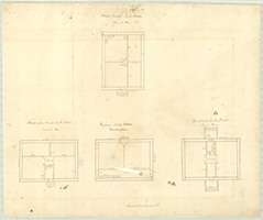 |
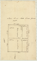
Book 17, page n-1 "Morris Canal Lock house, Farmington Canal lock house, Virginia Lock House, Erie Canal lock House," n.d. Shows: Ground Plan. (1 section) |
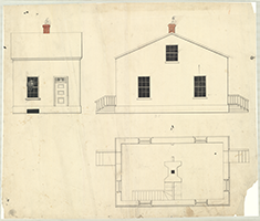 |
Book 17, page o-1 [Lock House B., Side View, Front View], n.d. Shows: Ground Plan. (1 section) |
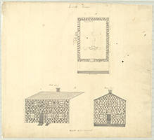 |
Book 17, page p-1 "Lock House A., Side View, Front View," n.d. Shows: Ground Plan. (1 section) |
 |
Book 17, page q-1 "Morris Canal Lock house frame," n.d. (1 section) |
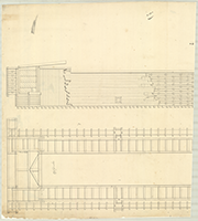  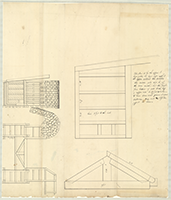 |
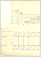
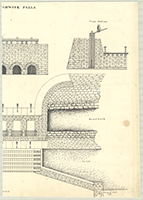
Book 17, page r-1 "River Locks at Aughwick Falls," n.d. (3 sections) |
 |
Book 17, page s-1 "Lock No. 2," n.d. (1 section) |
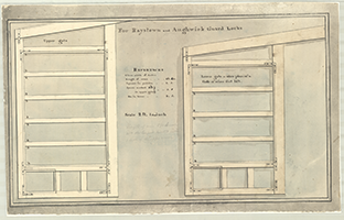 |
Book 17, page t-1 "For Raystown and Aughwick Guard Locks," n.d. (1 section) |
  |
Book 17, page u-1 [Locks], n.d. (2 sections) |
  |
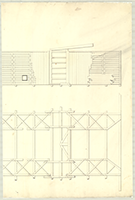
Book 17, page v-1 "Sluices at Aughqick Falls," n.d. Shows: Paddles, Front, Back & Edge, Dam Abutment, Elevation, Cross Section, Ground Plan, Protection Wall, Tow Path, Tow Bridge and Apron, Guard Bank, Tow Path. (2 sections) |
  |
Book 17, page page x-1 "Sluice at Mifflin & Berm," n.d. (2 sections) |
 |
Book 17, page page y-1 "Waste Weir, No. 1 & No. 2," n.d. (1 section) |
 |
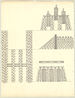
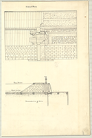
Book 17, page z-1 "Waste Weir," n.d. Shows: Construction. (1 section) |
 |
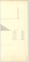
Book 17, page a-2 "Waste Weir, Elevation," n.d. (1 section) |
  |
Book 17, page b-2 "Stone Waste Weir," n.d. (2 sections) |
  |
Book 17, page c-2 "Waste Weir," n.d. Shows: Elevation, Sections of Sluice gate, Cross Section of Weir, Ground Plan, Transverse Section of Sluice. (2 sections) |